
Hovedøya is a 469-dekar island, about 47 hectares, in Oslo's inner harbour, 800 metres from the City Hall pier and seven minutes away on the public ferry (Store norske leksikon). Cistercian monks founded a monastery here in 1147, and what is left of it is among the most complete medieval monastery complexes in Norway: unfenced, free, open at any hour. Two cannon batteries from 1808 sit on the high ground, and the whole island has been legally protected since 2006.
From the ferry landing the ruins come first, then the high ground with the gun batteries, then the shore.
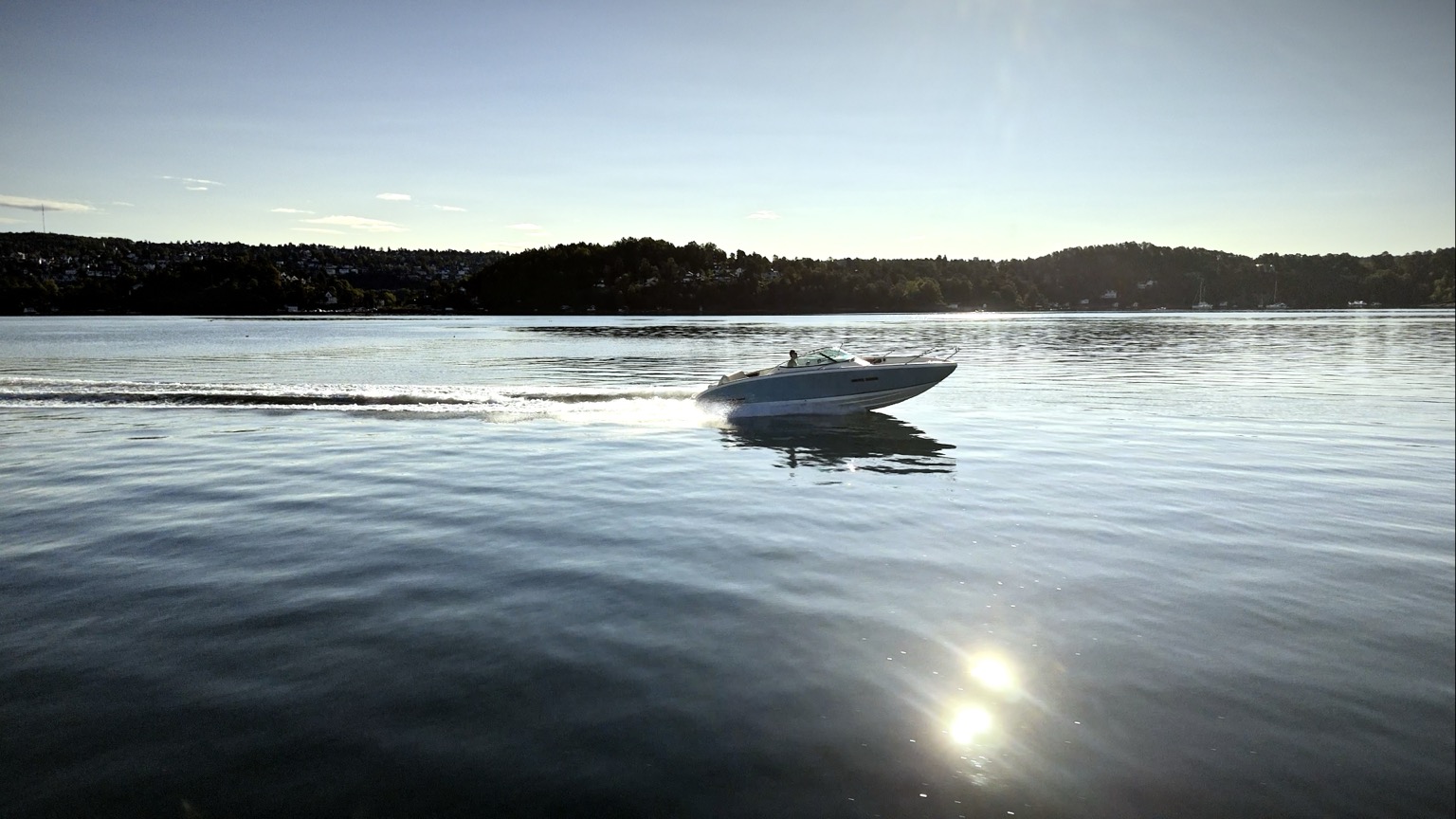
The seven-minute crossing to Hovedøya from City Hall pier
Off the ferry: what you are actually looking at
The crossing takes seven minutes and the change is abrupt. You leave a European capital at the City Hall pier and step off into forest, meadow and rock, with the same skyline you just left sitting on the horizon behind you.
A gravel path runs round the island in about 45 minutes. The monastery ruins are a short walk from the landing, the seasonal café sits beside them, the cannon batteries are up on the high ground, and the swimming rocks are on the western shore. Most people who plan an hour here end up staying two or three.
The ruins: what is still standing
The stone is the reason to come. According to lokalhistoriewiki.no, the ruins make up one of the most complete medieval monastery complexes in Norway, and you can walk into all of it for nothing, at any hour, with nobody checking a ticket.
The outer walls of the church nave and choir are standing, along with the remains of the three central pillars that carried the vault. The east, south and west ranges of the cloister are laid out clearly enough that you can tell the rooms apart, and the abbot's house sits to the north-west of the main complex. There is also a gatehouse, which lokalhistoriewiki notes is the only monastery gatehouse we have ruins from anywhere in Norway.
The site has been excavated twice: first by Fortidsminneforeningen between 1845 and 1847, then by the architect Gerhard Fischer from 1930 to 1938.
Stand inside the church footprint on a quiet morning and you can see out through the old doorway to the fjord. Early is better. The ruins in low light with nobody else in them are one of the better free hours Oslo offers.
1147: the monks from Lincolnshire
The monastery was founded in 1147 by Cistercians sent out from the abbey at Kirkstead in Lincolnshire, England. Beyond that, the two standard Norwegian references part company on who led them. Lokalhistoriewiki has abbot Philippus arriving with twelve monks, invited to Oslo by bishop Vilhelm. Store norske leksikon names the leader as Andverus and calls him Norwegian. Lokalhistoriewiki thinks the two names belong to the same man. The year and the sending house are agreed on by both. The house was dedicated to Saint Edmund alongside the Cistercian dedication to the Virgin Mary.
Cistercians were not casual settlers. The order ran on austerity and hard labour: draining marsh, clearing ground, farming with a discipline that outpaced most secular operations of the period. The monastery acquired large properties around Oslo quickly, Bygdøy hovedgård among them. Walk around Bygdøy today and you are on ground English monks once administered. The property values have moved somewhat.
The buildings went up in stages. A Romanesque stone church first, then a Gothic cloister, the pointed arches following the shift that swept European monasticism in the 13th and 14th centuries. The plan is the standard Cistercian one found from Yorkshire to Portugal: church to the north, cloister to the south, chapter house on the east range, stores and lay brothers' quarters on the west.
January 1532: the raid
The monastery ran for 385 years and the end of it was political.
The abbot at the time, Hans Andersen, had backed Christian II's attempt to win back the Norwegian throne the year before. In January 1532 Mogens Gyldenstierne, the commander at Akershus, attacked the monastery and took the abbot prisoner across the harbour to the fortress (Store norske leksikon). The abbot's own complaint said the place had been plundered and pulled down to the ground. That spring it was set on fire so that soldiers could not use it, and the estates went to the crown (lokalhistoriewiki.no).
Christian II had been deposed in 1523 and spent the years after trying to get the throne back; the abbot picked the losing side of a civil war. The Lutheran Reformation reached Denmark-Norway four years after the fire, in 1536 (Store norske leksikon).
Then the ruin itself was carried off. From the 1540s the burnt monastery was quarried for stone to strengthen Akershus Fortress, which is why the walls you see across the water from the island's western shore are partly built out of it.
The high ground: 1808 and after
After the monks came the military. Hovedøya sits high enough to see the whole harbour approach, and the Danish-Norwegian army used that.
In 1808, during Denmark-Norway's part in the Napoleonic Wars, two cannon batteries were built on the island to control the entrance to Christiania (Store norske leksikon). The stone walls of both are still up there, angles sharp against the treeline. Two powder magazines from the same period stand nearby, thick-walled and built low to the ground so an accidental blast would go up rather than out. They look indestructible, and after 218 years that seems to be a fair reading.
In 1847–48 the army added Lavetthuset, a store for gun carriages and equipment. It still stands and is used now and then for exhibitions.
The barracks camp
German occupation forces put up a barracks camp on Hovedøya during the war. What happened to it afterwards is the part most visitors have never heard.
From October 1945, the camp was used as an internment camp for women who had been involved with German soldiers. Around 1,100 of them were held there without charge or trial, for periods ranging from short to long, until April 1946 (Store norske leksikon). It is one of the least comfortable chapters in Norwegian post-war history.
Parts of the camp then became emergency housing. Oslo had a severe shortage of flats, and 150 families lived on Hovedøya into the mid-1950s. The barracks are gone now, the gun positions are overgrown, and the forest has taken most of it back.
A protected island
Hovedøya was given legal protection on 19 May 2006. The island now holds two nature reserves, a natural monument, two plant protection areas and a landscape protection area, and Store norske leksikon describes a varied cultural landscape with a rich flora, including rare species that grow nowhere else in the area.
The trees are what you notice first. Lime, oak, elm and hazel make a canopy that is unusually mixed for this latitude. The limes are the good ones in early July when they flower, a sweet heavy smell over the paths that pulls in every bee on the inner fjord. Norwegians call the tree lind, the same root that gives Lindøya its name across the water.
The wildflower meadows peak in June. Sheltered sun-facing slopes, rock outcrops and forest clearings sit close enough together to make a patchwork of microclimates, which is why the species count on a small island runs high. Orchids grow here.
The resident fox is a local celebrity. She turns up on the trails in broad daylight and sometimes lies down near Klosterkroa while people photograph her, apparently untroubled by any of it. Birdlife is good from spring through summer: oystercatchers on the rocky shore, warblers in the understory, the occasional grey heron standing still in the shallows like driftwood that might be alive. A great spotted woodpecker works the old oaks near the monastery. I heard it for the first time one May and have listened for it on every trip since.
Where are the best swimming spots on Hovedøya?
This is the part that surprises visitors. Hovedøya has some of the best swimming in the inner Oslofjord, and it takes nothing more than walking to the western side and stepping off a rock.
The western shore has flat rock shelves that drop straight into deep water, so there is no wading and no gradual entry. You sit on warm stone, lower yourself in, and it is chest-deep immediately. Visibility is good by urban fjord standards, three to five metres on a calm summer day, over a bottom of dark stone and kelp.
The eastern bays are deeper and arguably clearer, but they get less afternoon sun. On a warm July afternoon the western rocks win, because the stone holds heat. You swim, you dry off on the rock, you swim again. People bring books and food and stay for hours.
We run along Hovedøya's shoreline on most of our private cruises and I point the swimming spots out from the water every time. They look better from that angle: flat grey shelves, a line of swimmers, pine behind them, the city skyline in the distance.
Klosterkroa: a table among the ruins
Klosterkroa is the island's seasonal café, sitting beside the monastery ruins with outdoor tables looking across the old cloister ground. It serves coffee, soft drinks and light food. The menu is simple and the location does the rest.
Sitting beside 12th-century monastery walls while a fox watches you from ten metres away is not a sentence you expect to apply to an island seven minutes from a Scandinavian capital. Klosterkroa opens roughly May through September, weather depending. On warm weekends it fills by early afternoon, so the morning ferry is worth catching.
The loop trail: 45 minutes around the island
A well-kept gravel trail circles Hovedøya in about 45 minutes at an easy pace, and it passes everything: forest, meadow, monastery ruins, cannon batteries, the western swimming rocks, and the eastern shoreline looking south toward the outer islands. There is no climb to speak of. Pushchairs handle most of it, though a couple of rockier stretches near the western shore are easier without wheels.
The best view back to Oslo is from the western shore: Opera House, Barcode, Akershus Fortress, Aker Brygge, the Holmenkollen ski jump on the ridge above them. From here Oslo reads as a harbour city in a way the streets never show you.
Allow more than 45 minutes. The ruins alone can absorb half an hour if you read the information boards. A swim adds an hour. Klosterkroa adds however long you feel like sitting there.
How do you get to Hovedøya?
The Ruter island boat leaves from Rådhusbrygge (City Hall pier), the same terminal where most Oslofjord tours begin. Hovedøya is the first stop, seven minutes out. Departures are more frequent in summer than in winter, so check the current Ruter boat timetable before you set off. The island is served year-round.
A standard Ruter ticket covers the crossing. A 24-hour pass (around NOK 137 for adults as of July 2026; check current Ruter fares) gives unlimited rides and lets you hop between Hovedøya, Gressholmen, Bleikøya, Nakholmen and Lindøya on the same B1 route. The Oslo Pass also covers Ruter ferries. Buy in the Ruter app, at any Narvesen or 7-Eleven, or on board.
Toilets: near the café and the ferry landing, nowhere else on the island.
Food and drink: Klosterkroa is seasonal, roughly May through September. Outside those months bring everything. There is no shop.
Rules: Hovedøya is protected. Stay on marked trails in the protected areas. No picking flowers, no fires, no camping. Carry your rubbish out.
Ferry frequency, café season and ticket prices shift with the season. Check the linked Ruter pages before you go. Last reviewed: July 2026.
What is Hovedøya island in Oslo?
Hovedøya is the largest island in Oslo's inner harbour, 469 dekar (about 47 hectares), 800 metres from the City Hall pier and seven minutes away by public ferry. It holds the ruins of a Cistercian monastery founded in 1147 by monks sent from Kirkstead Abbey in Lincolnshire, two Napoleonic-era cannon batteries from 1808, and some of the best rock swimming in the inner Oslofjord. The island was given legal protection on 19 May 2006 and now contains two nature reserves, a natural monument, two plant protection areas and a landscape protection area. A loop trail takes 45 minutes, the ruins are free and always open, and a seasonal café, Klosterkroa, serves drinks and light meals beside them. Ferries run year-round on the Ruter B1 line, covered by a standard transit ticket or the Oslo Pass.
Nine centuries on one island
Hovedøya packs a startling amount into a space you can cross on foot in twenty minutes. English Cistercians farming the ground and collecting estates around Oslo. A fortress commander burning the place in 1532 over a deposed king, then his successors carting the stone across the harbour. Napoleonic gunners covering the approach to a city that was about to change hands between Denmark and Sweden anyway. A German barracks camp, then 1,100 women held in it without trial, then 150 families housed in what was left.
Now it belongs to picnickers, swimmers and one fox.
The ruins sit in the middle of all of it, open to anyone at any hour for nothing. The stones that were not carted off to Akershus have settled into the ground at angles that suggest permanence. Wildflowers grow between them in June and rain fills the old foundations in November, and the walls stay where they are through both.
On a full-day tour we sometimes anchor off the western shore and let guests swim while we point out the batteries on the ridge above. From the water the island reads as one long green ridge with monastery walls breaking the treeline. It is one of my favourite views on the inner fjord and I have seen it a few hundred times.
Bring a towel and a jacket. The wind off the fjord is always cooler than you think.
Hovedøya is the closest real nature to the Opera House. Seven minutes on the public ferry, 800 metres from the City Hall pier. You walk off the boat into a Cistercian monastery ruin from 1147 that is open at any hour and costs nothing, and the path from the church footprint down to the swimming rocks runs about 200 metres.
Sources
- Store norske leksikon — Hovedøya (469 dekar; protection on 19 May 2006 and the six protected areas; the 1808 batteries controlling the approach to Christiania; the internment of 1,100 women from October 1945 to April 1946; 150 families housed in the barracks into the mid-1950s).
- Store norske leksikon — Hovedøya kloster (founded 1147 from Kirkstead under Andverus; Mogens Gyldenstierne's imprisonment of abbot Hans Andersen over his support for Christian II; the ruins used as a quarry for the fortress).
- Lokalhistoriewiki — Hovedøya kloster (abbot Philippus and twelve monks, invited by bishop Vilhelm; the dedication to St Edmund and the Virgin Mary; what survives of church, cloister, gatehouse and abbot's house; excavations 1845–47 and 1930–38; the quarry years from the 1540s).
- Store norske leksikon — reformasjonen (the Reformation introduced in Denmark-Norway in 1536).
- Ruter — boat timetables and Ruter — tickets and prices (current departures and fares).
More from the fjord
Oslo’s Maritime History: A Thousand Years on the Water
From Viking longships to electric ferries, the Oslofjord has been Norway’s most important waterway for a millennium. A history told from the water.
History & NatureOslo Harbor Cleanup: How the City Reclaimed Its Waterfront
Between 2006 and 2008, Oslo dredged 444,000 cubic meters of toxic sediment from its harbor. The result: Sørenga, Tjuvholmen, and a fjord you can swim in again.
History & NatureThe Sinking of the Blücher: The Night Oscarsborg Saved Norway
On April 9, 1940, an obsolete Norwegian fortress sank Germany's newest heavy cruiser in the Drøbak narrows. The twelve hours it bought changed the course of the war.
See for yourself
Private Cormate T28 charter on the Oslo Fjord.
Up to seven guests. Fixed pricing. Departures from Tjuvholmen, Oslo.
Check pricing & availability