The inner Oslofjord holds over 40 islands within a 20-minute boat ride of central Oslo. Five of them (Hovedøya, Lindøya, Gressholmen, Bleikøya and Nakholmen) sit on Ruter's year-round B1 ferry circle from Rådhusbrygge and are covered by an ordinary day pass. Langøyene, the beach and camping island, has a summer-only B2. Hovedøya has monastery ruins from 1147; Steilene and the outer islands need a private boat.
The city falls away faster than you expect. One moment you are at Aker Brygge, surrounded by restaurants and glass towers and the low hum of a European waterfront in summer. Then the ferry rounds the harbour wall and the noise drops. The water deepens from harbour-grey to a clean, dark green. Ahead, a line of pine trees on a rocky shore, and behind them another island, and another beyond that.
Ten minutes from downtown Oslo you are at the first island. The air smells of salt and pine, the light hits the water at a lower angle, and the capital has become a backdrop. A short ferry ride on an ordinary transit pass leads to medieval monastery ruins, sandy beaches, free camping, and islands where no cars have ever driven. The Opera House, Karl Johan and Vigeland Park get most of the attention; the islands sit ten minutes off Aker Brygge and tend to be quieter as a result. For other common questions about the fjord, see our frequently asked questions.
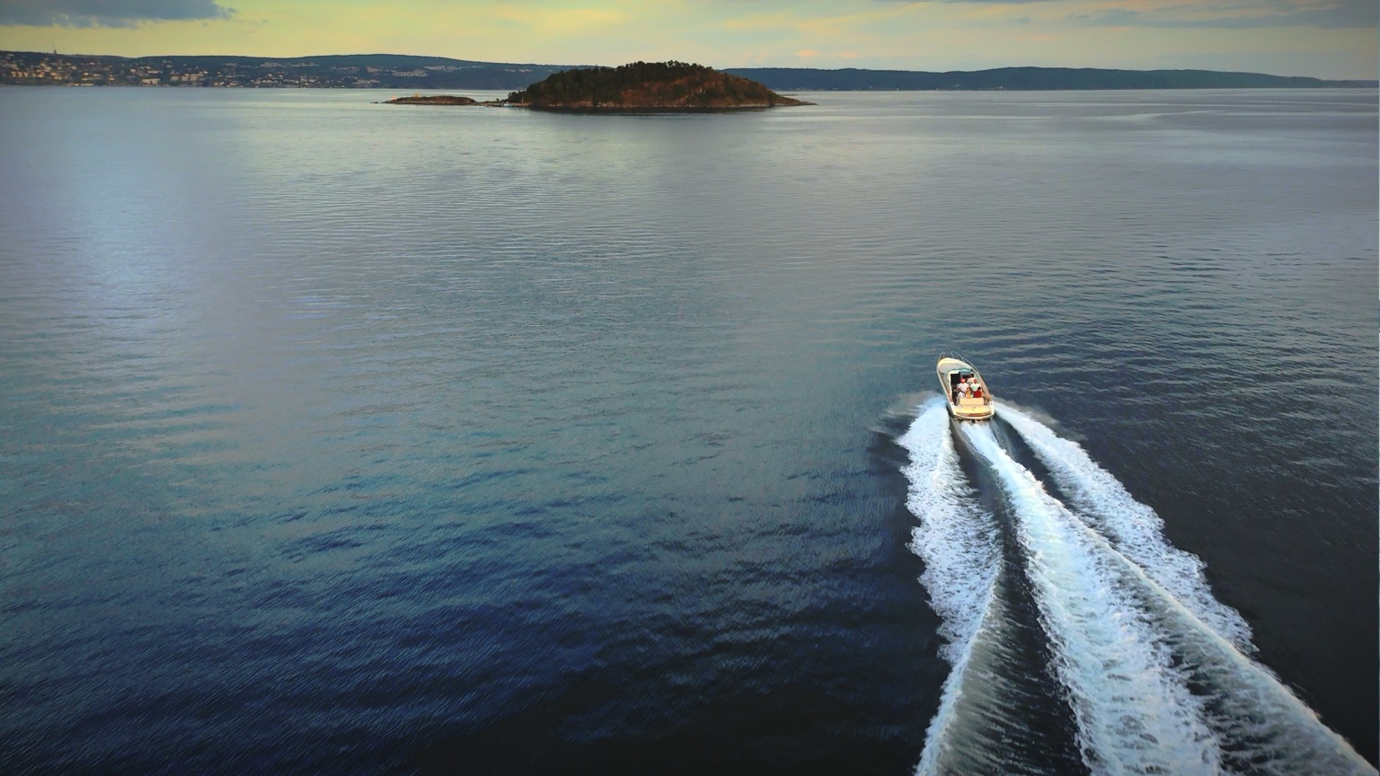
Heading toward one of the inner Oslofjord islands
Which island is best?
Start with what you want out of the day, because the islands are not interchangeable and the ferry ride between them eats time.
You want to swim in warm water. Langøyene. It has the only official city beach among the inner islands, sandy-bottomed and west-facing, with shallows that reach 23–24°C in July. Summer-only B2 ferry, thirty minutes out.
You want to dive off rocks into deep water. Hovedøya's western bays, seven minutes from the pier, where flat rock drops straight into clean green water. Nakholmen's southwestern beach is the family version: bathing jetty, diving board, raft anchored offshore.
You want history. Hovedøya, easily. Monastery ruins from 1147, Napoleonic cannon batteries from 1808, gunpowder depots, and wartime remains, all on one 45-minute walking loop.
You want to walk and eat. Gressholmen, which is really three islands joined by causeways, with a tavern that has served food with a fjord view since 1930.
You want quiet. Bleikøya on the ferry network: rocky shore, old orchards, colourful cabins, few visitors. For actual solitude, Steilene, which means a private boat.
You have two hours and no plan. Hovedøya. The ruins, the loop trail, a swim from the rocks and a seasonal café, all within a seven-minute crossing.
You want museums. Bygdøy, technically a peninsula, treated best as its own day.
The rest of this guide is the long version, island by island, from the closest to the furthest out.
Over 40 islands, and most of them empty
The inner Oslofjord, the stretch of water between Oslo and the narrows at Drøbak (roughly 40 kilometres south), contains over 40 islands. Some are large enough to hold communities of summer cabins. Others are bare rock, just big enough for a cormorant to dry its wings. A handful are reachable by public ferry. The rest require a private boat or a kayak.
The islands fall into three groups. The inner cluster (Hovedøya, Gressholmen, Bleikøya, Nakholmen, Lindøya) sits within two kilometres of the city centre and is served all year by the B1 ferry. Further south, Langøyene is the beach and camping island, reached by a summer-only B2. Beyond the ferry routes, the Steilene archipelago and the outer islands are only accessible by private boat. That is where you find the solitude.
And then there is Bygdøy, technically a peninsula, but it feels like an island, and it holds more museums per square kilometre than almost anywhere in Scandinavia.
Hovedøya (HOO-ved-oy-ah) — The history island
The largest of the inner islands at 40 hectares, and the one with the deepest roots. Hovedøya sits just 800 metres from the City Hall pier. You can see it from Aker Brygge: that dark, forested ridge across the harbour. The ferry takes seven minutes.
A gravel path leads uphill through mixed forest (lime trees, oak, elm, hazel) and then opens onto the ruins of a Cistercian monastery founded on 18 May 1147. The monks came from Kirkstead Abbey in Lincolnshire, England. Abbot Philippus arrived with 12 monks and several lay brothers, and over the next four centuries the house came to control 443 properties across the Oslo region, including estates at Bygdøy, Bogstad, Frogner and Ullern. Those are now among the city's most expensive neighbourhoods. (Store norske leksikon names a Norwegian, Andverus, as the founding leader instead of Philippus; the other sources agree on Philippus, which is the version used here.)
The Romanesque church foundations and Gothic cloister walls are remarkably well-preserved. You can walk through them freely, at any time of day, at no charge. Information boards provide context. This is the oldest monastery ruin in Oslo, nearly 900 years old. On an early morning visit you will likely have the place to yourself.
The monastery's end came violently. In 1532, the abbot was imprisoned during the upheaval of the Reformation, and the abbey was looted and set ablaze. Its stones were later quarried to reinforce Akershus Fortress across the harbour, the same fortress you can see from Hovedøya's western shore today.
The island's military history is layered on top of the medieval. Two Napoleonic-era cannon batteries from 1808 guard elevated positions, their stone walls still intact. Two gunpowder depots from the same period survive nearby. During the Second World War, German forces established a camp with multiple barracks here, and the island was shelled during the 1940 invasion when the warship Lützow targeted Norwegian anti-aircraft positions.
The island is in full use today. The western bays have flat rocks that drop into deep, clear water, some of the best swimming in the inner fjord. A large central meadow fills with picnickers in summer. Wildflowers bloom across the island in June, and the variety is remarkable for such a compact space. A resident fox has become something of a local celebrity, appearing on walking trails and near the seasonal café, Klosterkroa, which serves drinks and light meals near the monastery ruins. We pass by on our tours and I always point it out from the water. The whole island looks different from that angle.
A walking trail circles the island in roughly 45 minutes at a comfortable pace. The views back to the Oslo skyline from the western shore are worth the visit alone.
Getting there: Ruter ferry line B1 from Rådhusbrygge (City Hall pier), 7 minutes, with a summer-only B1X running direct to the island as well. Covered by a standard Ruter ticket, day pass, or Oslo Pass. Departures are frequent in summer and reduced in winter; the Ruter boat timetable has the current version.
Gressholmen (GRESS-hol-men) — The nature reserve
Gressholmen looks small from the ferry, and it is; narrow causeways connect it to two other islands, Rambergøya and Heggholmen, forming a nature reserve cluster that gives you two to three hours of walking through wildflower meadows, rocky shorelines, sheltered bays, and light forest.
Gressholmen also has a place in aviation history. Norway's first civilian airport opened here on 16 July 1927, when a Dornier Wal flying boat from Deutsche Luft Hansa put down in the sheltered water between the islands, and for the next twelve years this was the country's only international airport. Fornebu took the bulk of the traffic when it opened on the mainland in 1939, but the seaplanes stayed on: Gressholmen kept operating until 1952. Traces of the infrastructure survive for those who know where to look. Ask at Gressholmen Kro, the seasonal tavern that has served cold drinks with a fjord view since 1930.
The kro is the island's heart in summer. Outdoor tables, ice cream, light meals, and a view south across the fjord. It fills up on warm weekends, so a weekday visit or early arrival is worth the planning.
Most of the island cluster is a designated nature reserve, so visitors must stay on marked trails in protected areas. No picking flowers, no disturbing wildlife. The birdlife is rich, particularly in spring. The wildflower meadows peak in June and July. The southern beaches are sandy and sheltered, with shallow water that warms quickly in the sun.
On the outer island, Heggholmen, a small lighthouse sits at the edge of the rocks. It is one of the quieter spots in the inner fjord: you hear the water against the stone and little else.
Getting there: Ruter ferry line B1, approximately 18 minutes from Aker Brygge. Standard Ruter ticket or Oslo Pass.
Langøyene (LANG-oy-en-eh) — The beach island
Langøyene is the island Oslo locals argue about: it has the best beach in the inner fjord, and it gets crowded on warm weekends.
The name means "the long islands" because it was originally two separate islands, connected in the 1960s and 70s when the gap between them was used as a landfill site. The fill has since been covered, landscaped, and forgotten. What remains is a single island with a large sandy beach on the western side, a sandy bottom that retains heat, and shallows that reach 23–24°C in July. That is warm by any standard, and for Norway it is borderline tropical.
Langøyene is the only inner island with an official city beach, and one of the very few places in the inner Oslofjord where free camping is allowed. Tents only, in a designated area on the north side, for a maximum of two consecutive nights. No campfires, no motorhomes, minimum three metres between tents, quiet hours from 11pm to 7am. Pitching a tent on a fjord island with renovated shower facilities and a sandy beach, thirty minutes by ferry from downtown Oslo, for zero kroner: that is rare for any European capital. I would say unique, but someone will correct me.
Beyond the beach you will find a volleyball court, a football pitch, a kiosk with basic provisions in peak summer, and walking trails across the island's interior. The southern tip has a separate naturist beach, well-screened from the main area by terrain and vegetation.
On a warm summer weekend, the ferry can be standing-room-only and the camping spots fill by early afternoon. Weekdays are different: quiet, spacious, the beach half-empty.
Getting there: Ruter ferry line B2 from Rådhusbrygge, approximately 30 minutes. Summer only (roughly May to September). Standard Ruter ticket or Oslo Pass. No regular winter service.
Bleikøya (BLAY-koy-ah) — The cabin island
Bleikøya has no cars, no shops, and no restaurants. What it does have is roughly 200 summer cabins, painted in mandated colours (red, blue, green, or yellow) lining narrow gravel paths under old fruit trees. Walking it feels like stepping into a different era, and in a sense you are: many of these cabins were built in the early 1900s as retreats for working-class Oslo families who could not afford country estates.
The cabins sit on municipality-owned land with hereditary leases. Waiting lists stretch decades. When one becomes available, it is an event. The community is self-governing, with its own association, its own rules, and a fierce attachment to the island's quiet character. Visitors are welcome on public paths, but this is someone's neighbourhood rather than an attraction.
Bleikøya is best for walking, not swimming. The shoreline is rocky and exposed. But the trails through the island's cultural landscape, past old orchards and colourful cabin neighbourhoods, are some of the most charming in the inner fjord. The western shore has rich birdlife, especially in spring.
Getting there: Ruter ferry line B1. Standard Ruter ticket or Oslo Pass.
Nakholmen (NAHK-hol-men) — The small one
The smallest of the cabin islands, and the most approachable for visitors. Roughly 200 holiday cottages share this compact island, but the atmosphere is more open than on Bleikøya or Lindøya. The public paths and swimming spots feel welcoming in a way the other cabin islands do not always manage.
The best swimming in the cabin island group is here. The southwestern side has a small beach with a bathing jetty, a diving board, and a swimming raft anchored offshore. On a warm afternoon the raft becomes the centre of gravity for the whole island: teenagers jumping, children swimming out, adults floating on their backs with their eyes closed.
From the southern rocky shore you get one of the best views of any island in the inner fjord. The Oslo skyline to the north, the open water of the outer fjord to the south, Langøyene off to the southeast. On a clear evening the sunset light catches the city's glass towers and turns them gold. You start to understand why people wait decades for a cabin here.
Getting there: Ruter ferry line B1. Standard Ruter ticket or Oslo Pass.
Lindøya — The largest cabin island
With roughly 300 cabins, Lindøya is the most populated of the inner islands and the one with the strongest sense of community. The cabins date from the early 1900s, originally built as summer retreats for workers who could not afford country properties. This was a distinctly Norwegian idea: everyone, regardless of income, should have access to the coast. Social democracy applied to leisure.
Many cabins still lack running water. Residents use community water points. No cabin may be taller than a single storey with loft, and the colour mandate (red, blue, green, or yellow) creates the visual identity visible from the ferry long before you arrive. From the water, the rows of painted cabins against the shoreline look like a postcard from a country that does not quite exist any more.
A walking loop circles the island perimeter, passing through cabin neighbourhoods and along the rocky shore. Swimming is only advised at two designated spots, Kjøkkenodden and Badestadion, as the rest of the shoreline has soft, sinking ground. A small seasonal shop near the ferry landing sells basics.
Getting there: Ruter ferry line B1 from Aker Brygge. Standard Ruter ticket or Oslo Pass.
Bygdøy (BIG-doy) — The museum peninsula
Bygdøy is technically a peninsula, connected to the mainland since the 1800s. But it still feels like an island. You cross a narrow neck of land and the character shifts: trees replace apartment blocks, the pace drops, and the museums begin.
No other area this size in Scandinavia concentrates as many major museums. The Kon-Tiki Museum holds the original balsa raft that Thor Heyerdahl sailed across the Pacific in 1947, plus the reed boat Ra II from his 1970 Atlantic crossing. Next door, the Fram Museum houses the 39-metre polar ship that carried Fridtjof Nansen across the Arctic and Roald Amundsen toward the South Pole. You can board the ship, walk the decks, and peer into the cabins where men spent years locked in polar ice.
The Norwegian Folk Museum is the country's largest open-air museum, with over 150 relocated buildings from every region of Norway. Its centrepiece, the Gol Stave Church, is a 12th-century wooden church originally from Hallingdal, reconstructed here in 1885. The Museum of the Viking Age is closed for a major rebuild and expected to reopen in 2027. The Oseberg ships are not on display until then, so check the museum's site before planning a visit around them.
Bygdøy also has beaches. Huk, at the peninsula's southwestern tip, is Oslo's most popular: a wide sandy stretch backed by parkland, with a separate nudist section on the western side. A 15-minute walk through the Kongeskogen (King's Forest) leads to Paradisbukta, a sheltered bay with gentler water, better suited for families with young children. The 6.5-kilometre waterfront trail that circles the peninsula passes through old-growth forest, along rocky shores, and past the royal family's summer residence. If you only do one walk in Oslo, I would pick this one.
Getting there: Bus 30 from Jernbanetorget, year-round, or the summer-season Ruter ferry from Rådhuskaien to Dronningen and Bygdøynes (check the boat timetable). Also reachable by bicycle in roughly 20 minutes from the city centre.
Steilene (STAY-leh-neh) — The outer archipelago
Beyond the cabin islands and the ferry routes, the character of the Oslofjord changes: the water gets deeper, the islands rockier, the trees sparser. The Steilene sit south of Nesodden, a cluster of small islands at the boundary between the inner fjord and the open water.
The archipelago includes Storsteilene (the largest), Fyrsteilene (with a historic lighthouse) and the islet Knerten. Protection status and any landing restrictions for individual islets are listed in Miljødirektoratet's Naturbase, worth a look before you approach one in your own boat. The islands were once industrial sites, used for oil storage to serve the fjord's commercial shipping. The infrastructure has been cleaned up and removed, and the natural landscape has returned, part of Oslo's broader reclamation of its industrial waterfront.
Harbour seals turn up on the low rocks here from time to time, wandering in from the outer-fjord haul-outs at Hvaler, Færder and Bolærne. Usually it is a single animal, and there is no guarantee of even that. We take guests out to Steilene regularly on our private boat tours, and watching someone spot a seal for the first time never gets old. Last summer a guest from Berlin just stood there shaking his head, saying "this is twenty minutes from a capital city?" over and over.
Getting there: No public ferry. Accessible only by private boat or kayak. Kayak rental is available from Bjørvika and Sjølyst, though the distance requires experience and good conditions.
What is beyond the inner Oslofjord?
The inner islands are the ones you can reach in a morning. The Oslofjord stretches 100 kilometres south to the open sea, and the further out you go, the more the landscape opens up. Each of these destinations deserves its own article, but a brief orientation:
Nesodden: A large peninsula directly across the fjord from Oslo, with 21,005 residents as of 1 January 2026, most of whom commute by electric ferry. The 20-minute crossing from Aker Brygge gives panoramic views of the skyline, the inner islands, and the forested shores. Having done it myself a few times, I would take it over the metro. On the peninsula itself, a thriving art community has grown around galleries, studios, and small festivals; Galleri Vanntårnet is the municipality's designated millennium site.
Drøbak and Oscarsborg: Where the fjord narrows to its tightest point, reachable on a full-day tour and well beyond the range of a short trip. The fortress island of Oscarsborg guards the passage. Early on 9 April 1940 the main battery on Søndre Kaholmen opened fire on the heavy cruiser Blücher, the Kopås and Husvik batteries followed, and the torpedo battery on Nordre Kaholmen put two torpedoes into her. The ship went down at 06.22, and the delay let King Haakon VII, the government and Norway's gold reserves leave Oslo by train. The fortress commander, Birger Kristian Eriksen, was highly decorated for it. Oscarsborg is now a museum, hotel and summer opera venue, reached by a five-minute ferry from Drøbak harbour.
Hvaler: The archipelago at the mouth of the fjord, on the Swedish border. Ytre Hvaler, Norway's first marine national park, was established on 26 June 2009 and covers 354 square kilometres of sea, seabed and skerries. Island hopping on the local ferry is one of the best day trips from Oslo. Train to Fredrikstad (80 minutes), then bus to the islands.
How many islands can you visit in a day?
Three to four of the inner islands is comfortable. The Ruter B1 ferry runs a circular route (Hovedøya, Lindøya, Gressholmen, Bleikøya, Nakholmen) so you can hop on and off throughout the day on a single ticket. Most islands need one to three hours. A typical day might be Hovedøya in the morning for the monastery ruins and a swim from the western rocks, Gressholmen for lunch at the kro, and Nakholmen for an afternoon swim from the jetty.
Adding Langøyene means taking the separate B2 ferry and committing more time. The longer crossing and the beach make it a half-day destination on its own. Bygdøy is best treated as a separate trip, given the museum time involved.
Island comparison
| Island | Best for | Swimming | Ferry | Time needed |
|---|---|---|---|---|
| Hovedøya | History, walking, picnics | Good (rocks) | B1, 7 min (B1X in summer) | 2–3 hours |
| Gressholmen | Nature, café, birdwatching | Good (sheltered bays) | B1, 18 min | 2–3 hours |
| Langøyene | Beach, camping | Excellent (sandy) | B2, 30 min (summer) | Half day+ |
| Bleikøya | Walking, cabin culture | Limited | B1 | 1–2 hours |
| Nakholmen | Swimming, views | Good (jetty + raft) | B1 | 1–2 hours |
| Lindøya | Cabin heritage, photography | Designated spots only | B1 | 1–2 hours |
| Bygdøy | Museums, beaches, walking | Excellent (Huk, Paradisbukta) | Ferry or Bus 30 | Half day+ |
| Steilene | Wildlife, solitude | Rocky shores | Private boat only | 2–3 hours |
How do you get to the Oslofjord islands?
Three ways to reach the Oslofjord islands, and the one you choose determines what you see.
Ruter ferry
The public ferry departs from Rådhusbrygge (City Hall pier, Rådhusbrygge 4). Line B1 runs the circular inner island route year-round, frequently in summer and on a thinner winter schedule; a summer-only B1X adds direct departures to Hovedøya, and B2 runs to Langøyene in summer. All of them are covered by a standard Ruter ticket, day pass, weekly pass, or Oslo Pass. A single day pass gives you unlimited ferry rides for the entire day. Buy tickets via the Ruter app, at any Narvesen or 7-Eleven kiosk, or on board.
Line numbers, ferry frequencies and ticket prices are set by Ruter and change with the season. Check the boat timetable and current ticket prices before you go. Last reviewed: July 2026.
Private boat
This is how you reach the islands the ferries skip. The Steilene, the unnamed coves on the back side of Gressholmen, the flat rocks south of Hovedøya where no path leads. A private charter also gives you the freedom to anchor where the light is best, stay as long as you want, and combine islands that would take half a day by ferry schedule. A full-day luxury charter can cover the inner islands and the outer archipelago in a single trip.
Kayak
Kayak rental is available from several locations around the inner harbour, including Bjørvika and Sjølyst. The crossing to Hovedøya and Gressholmen is straightforward in calm conditions. Going further, to the Steilene or the outer islands, requires experience, proper equipment, and a weather window.
When is the best time to visit the Oslo islands?
June to August: All ferry routes running. Swimming. Cafés and kiosks open. Wildflowers on Gressholmen. The water reaches 17–20°C, occasionally higher in sheltered bays. The longest days (sunset after 10pm in June) mean you can start an island trip at 5pm and still have hours of light. The trade-off is crowds, particularly on warm weekends.
May and September: My recommendation if you can manage it. It is quieter, the light softer, the colours deeper. Ferries run on reduced schedules but are still frequent enough for island hopping. The water is too cold for most swimmers, but the walking and the atmosphere are at their best. Hovedøya's monastery ruins in September morning light, with no one else around, are worth the trip alone.
October to April: Ferries to Hovedøya run year-round, though on a reduced schedule. The other islands are harder to reach. But the inner fjord in winter has its own stark beauty: pine trees dark against grey water, the monastery walls dusted with snow, the city skyline sharp in cold air. You will have the island almost to yourself.
What should you bring to the Oslo islands?
The islands are close to the city but have few facilities. Pack accordingly. In summer: sun cream, water, a towel, and something to sit on. Food, especially if heading to Langøyene or any island without a café. Water shoes help on rocky shorelines. A light layer for the ferry crossing, even on warm days, because the wind on the water is always cooler than on land.
In shoulder season: a proper jacket, because the wind off the fjord is cold even in mild weather. Sturdy shoes for the trails, which can be slippery after rain. Binoculars if you care about birdlife: Gressholmen and Bleikøya have the most to see.
Toilet facilities are limited on most islands. Use the facilities at ferry terminals and cafés when available. Carry out all rubbish; there are few waste bins on the smaller islands.
The part of Oslo most people miss
Most visitors see the Opera House, the Vigeland sculptures, Karl Johan. They eat well, they have a good time, and they go home without ever seeing the turquoise cove behind Gressholmen, the monastery ruins on Hovedøya in early morning light, or the seals hauled out on the rocks at Steilene. They do not lie on Langøyene's beach and think about the fact that this is free, thirty minutes from a European capital, and warm.
The ferry leaves from Aker Brygge every fifteen minutes. Bring a towel.
Pick three islands, not eight. Hovedøya plus a swim stop on Langøyene plus a coffee at Gressholmen Kro is enough material for one good day. Try eight in a day and you've spent more time on the ferry than off it.
More from the fjord
Island Hopping on Oslo's Public Ferries: The Free Day Trip
A NOK 137 Ruter day pass unlocks six islands, free camping, monastery ruins, and hidden beaches. The complete guide to Oslo's public ferry network.
GuideThe Best Beaches and Swimming Spots on the Oslofjord
From Huk and Sorenga to the coves only boats can reach. Oslo's best beaches, water temperatures, and where locals actually swim.
On the WaterOslo Hidden Gems a Local Would Actually Show You
The coves, seal rocks and wooden streets that pass one test: would a local go? An honest guide to Oslo's hidden gems, from the water and on foot.
See for yourself
Private Cormate T28 charter on the Oslo Fjord.
Up to seven guests. Fixed pricing. Departures from Tjuvholmen, Oslo.
Check pricing & availability