
Line 1 of the Oslo metro ends at 469 metres above sea level. Frognerseteren is the highest station in the network, and the 478 metres between it and Stortinget make the greatest elevation difference inside any metro network in the world. Past the last houses at the top the city stops: this is the edge of Nordmarka, 430 square kilometres of pine forest and lakes stretching north. Hiking in Oslo starts on a metro platform, with the same zone 1 ticket you used to reach the Opera House.
Two end stations do most of the work. Line 1 climbs through Holmenkollen to Frognerseteren; line 5 runs north to Sognsvann, a forest lake with a gravel track around it and swimmers off the jetties all summer. From either platform you walk straight onto a trail network that volunteers have kept open since the late 1920s. Oslomarka has 2,800 kilometres of blue-marked summer trail, cleared and repainted every spring.
All of it is free. Under allemannsretten, the Norwegian right of public access, uncultivated land is open to everyone: walking, berry-picking, even camping, as long as your tent stands at least 150 metres from the nearest inhabited house and you move on after two nights. The forest has no ticket booth and no opening hours. The metro does, so read the 2026 note below before you plan a walk from Sognsvann.
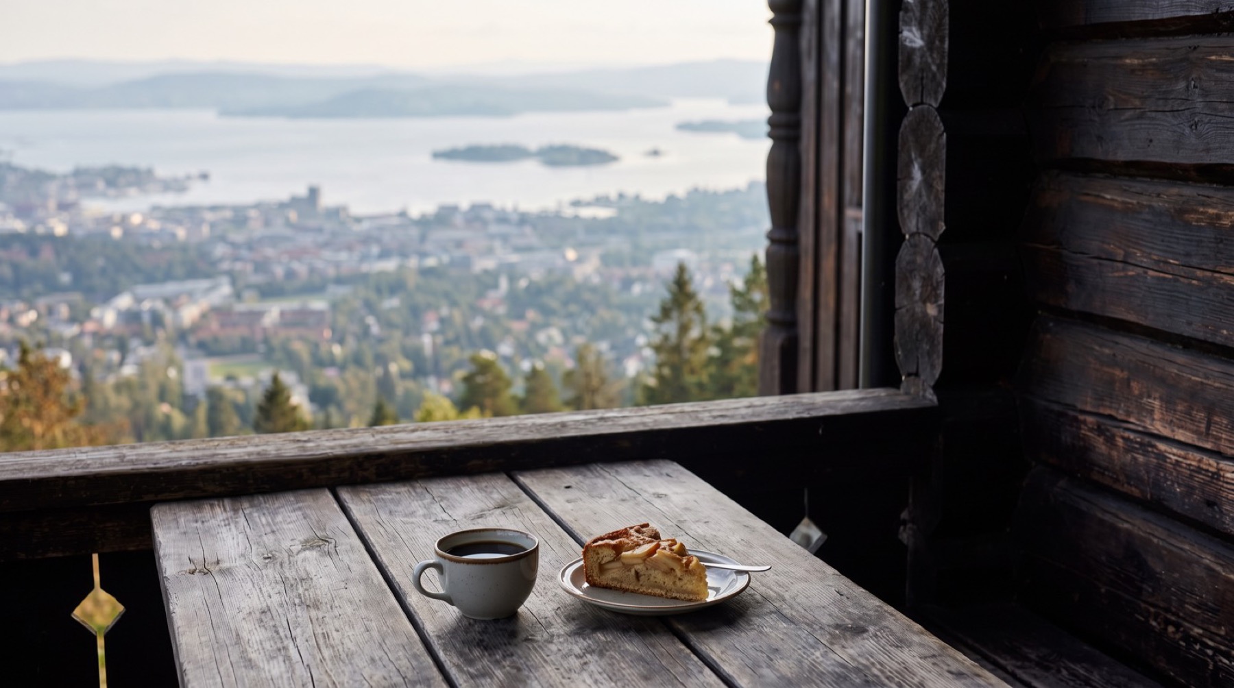
Nordmarka: 430 square kilometres of forest, beginning where the metro ends
Two stations, one 2026 warning
Frognerseteren (line 1) is the high gateway. The station sits at 469 metres in an area with almost no residents, a restaurant, and trails leaving in every direction. In winter the same trails carry skiers; in summer they carry everyone else.
Sognsvann (line 5) is the flat gateway. The lake lies a short walk from the platform, and the paths fan out from its northern end towards Ullevålseter and the deeper forest.
The warning concerns the second of these. From Monday 6 July to Sunday 16 August 2026 the metro north of Majorstuen is closed for upgrade works, and Sognsvann, Kringsjå, Holstein, Østhorn, Tåsen, Berg, Ullevål stadion, Forskningsparken and Blindern have no metro service at all during the window. Bus 5B covers Majorstuen to Sognsvann and bus 4B covers Majorstuen to Nydalen, according to Ruter's own project page. Line 1 is unaffected, so Frognerseteren and Vettakollen stay reachable by train.
A standard adult single for zone 1 costs 46 NOK as of July 2026 and is valid for 60 minutes with transfers. Ruter raises fares once a year, on the third Sunday in January, so check the current prices before you travel.
Four hikes, with DNT's own numbers
The distances below are the Norwegian Trekking Association's official figures from UT.no, not estimates.
| Walk | Start from | Distance and time |
|---|---|---|
| Sognsvann loop | Sognsvann, line 5 | 3.7 km, about 1 hour, 17 metres of climb |
| Vettakollen summit | Vettakollen, line 1 | 3.2 km return, about 1 hour, 203 metres of climb |
| Ullevålseter café | Frognerseteren or Sognsvann | About 1 hour each way |
| Skjennungstua | Frognerseteren | About 4 km, or roughly 6 km from Sognsvann |
The Sognsvann loop is gravel the whole way round, graded an easy walk and open year-round. It is wheelchair-accessible and manageable with a pram, there are approved fire pits by the water, and cycling is banned on the lakeside path. This is as gentle as marked walking gets, and correspondingly busy on fine Sundays.
Vettakollen is the short climb with the long view. From Vettakollen station on line 1, follow Huldreveien up from the platform, turn right on Gulleråsveien, left into Bånntjernveien, and take the marked path to the summit at 419 metres. The name comes from vete, the beacon cairn that once stood on the ridge as a signal point. From the top you see Holmenkollen, the Oslofjord and the city centre in one sweep; UT.no counts it among the finest viewpoints in Oslo, and the numbers back that up: an hour, round trip, from a metro platform. You can also approach from Sognsvann, about 3.5 km on blue-marked trail past the small tarn of Båntjern.
Ullevålseter is a café at a crossroads in the forest, an hour's walk from the nearest platform. Christiania municipality bought the place and the forest around it in 1923, and it has served food since 1927. Gerd and Reidar Otto Ullevålseter ran it for sixty years from 1958, taking over from his parents Paul and Emma; Reidar Otto died in December 2019, and the next generation of the family has the counter now. Open Tuesday to Sunday 9–17, closed Mondays; check current hours, which shift with the season. Cinnamon buns, waffles and soup at the end of the walk; the shortest approach is from Frognerseteren over Frønsvollstråkka.
Skjennungstua sits high on the ridge with a view out over the forest, also reached over Frønsvollstråkka. Thorvald Astrup drew it and it went up in 1910. Skiforeningen ran the serving until 1952, when the cabin was sold so the association could afford to rebuild the Holmenkollen ski jump ahead of the 1952 Winter Olympics. Gudbrandsdalslaget i Oslo owned it until 1991, Hanne and Bjørn Stenen bought it that year after running it since 1980, and Petter Martinussen has held the kitchen since 2011. There are homemade cakes and bread when it is staffed, and a self-service counter around the clock with soft drinks, chocolate and the day's leftover baking, paid for on trust.
Blue marks, not red Ts
Most English articles about hiking in Norway mention the red T painted on cairns. That marking belongs to the mountains. In Oslomarka the summer trails are marked blue, maintained by DNT Oslo og Omegn, local trekking clubs and volunteers who walk the routes every spring, repainting faded marks and moving them to new trees where old ones have fallen. The working principle: you should always be able to see the next mark from the last one.
Red paint in these forests means something else. Red marks are ski trails, maintained by Skiforeningen and the municipality. They are useful in February and misleading in July.
For maps, UT.no is the standard: free, official and usable offline.
Swimming in the forest
Sognsvann is the obvious swim: grass banks, rock slabs, a sandy bottom, several jetties and a swim raft, plus a kiosk and fire pits. Øvresetertjern, up between Frognerseteren and Tryvannshøgda, is an official municipal bathing spot and the natural stop on the way down from the upper trails. Svartkulp, just beyond Sognsvann, has a designated naturist area at its north and east end. And Båntjern, the tarn on the Vettakollen route, is a small forest pond with a path all the way round.
One lake is off limits. Maridalsvannet, the biggest lake in Oslo, supplies 80 percent of the city's drinking water. Swimming, fishing, grilling and boats are banned in its catchment, and you are required to keep 50 metres from the water, a rule that applies to dogs too. Wardens patrol it.
If you want salt water instead, the fjord's bathing spots lie in the other direction on the same ticket.
When to go hiking in Oslo
May to October is the green season. Summer holds 18–22°C with 18 to 19 hours of daylight, which means you can start a hike at six in the evening and come down in full light. Autumn colours peak between 25 September and 10 October, when Nordmarka turns gold and red. Winter brings −5 to +2°C, snow on the trails from December to March and about six hours of light. The forest converts to ski country and the red-marked routes take over. If you walk rather than ski in winter, bring ice grips.
For how the forest months line up with the water, see the fjord month by month and our notes on winter on the Oslofjord.
What to bring
For the Sognsvann loop, whatever you are wearing will do. For the other walks, the standard advice holds: sturdy footwear, layered clothing (the temperature swings more than a city day suggests), a water bottle and a small backpack. A map or the UT.no app settles any argument about which fork to take. In winter, ice grips.
Norwegians bring a matpakke, the packed lunch, and eat it on a rock with a view. The cafés at Ullevålseter and Skjennungstua exist for everyone who didn't.
Nordmarka without the logistics
Our own working days are spent on the fjord, but the land side of the company covers the forest. See Oslo runs a private full day that ends in Nordmarka: eight hours with a chauffeur and a guide, from the Opera House roof through Holmenkollen and Frognerseteren, lunch reserved along the way, finishing with the last hundred metres on foot to a lakeside camp in the forest, warm food and something hot in the cup while the city sits below through the trees. In winter the camp comes with a bonfire. Up to seven guests, from 32,368 NOK including VAT.
That is the forest with the planning removed. The metro version costs 46 kroner and a matpakke, and since Nordmarka is the most used stretch of forest in Oslomarka, you will not walk it alone.
Just check the day of the week before you promise anyone waffles. Ullevålseter is closed on Mondays.
Fares, café hours and engineering works all move. Ticket prices and the summer 2026 metro closure were checked against Ruter in July 2026; walking distances come from UT.no. Follow the links for the current version of any number here.
More from the fjord
Oslo on Foot: Self-Guided Routes and Walking Tours
Four self-guided Oslo walking routes with real distances, how the tip-based free tours actually work, and when a private walk earns its price.
GuideFishing the Oslofjord: What You Can Catch, Where, and the Rules You Need to Know
Cod is fully protected and some zones are closed to all fishing. Here is what you can still catch in the Oslofjord, where, and the current rules.
GuideDock and Dine: Restaurants You Can Reach by Boat on the Oslofjord
From Aker Brygge seafood to Drøbak harbor cafés and island taverns with century-old views. Every waterfront restaurant worth a visit on the Oslofjord.